
Webalizerのアクセス元の国の表示が出来ていなかった。
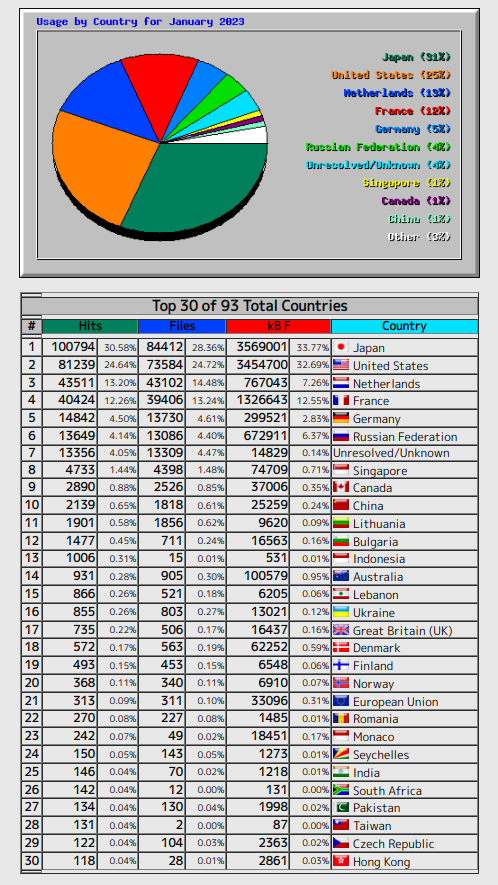
これですね。この下図のグラフなどの表示が出来ていませんでした。
ミスを修正しておきました。
# The GeoIP option enables or disables the use of geolocation
# services provided by the GeoIP library (http://www.maxmind.com),
# if available. Values may be ‘yes’ or ‘no, with ‘no’ being the
# default. Note: if GeoDB is enabled, then this option will have
# no effect (GeoDB will be used regardless of this setting).
GeoIP yes
# GeoIPDatabase specifies an alternate database filename to use by the
# GeoIP library. If an absolute path is not given as part of the name
# (ie: starts with a leading ‘/’), then the name is relative to the
# default output directory. This option should not normally be needed.
GeoIPDatabase /usr/share/GeoIP/GeoIP.dat
と、設定すれば、国の国旗やグラフなど表示されました。
それでは、今後ともWebalizerをお楽しみください。